Remote Sensing & GIS in Agriculture – Complete Guide
Published: 14 Aug 2025
Many farmers know their fields like the back of their hand, yet they still face puzzling questions: Why does one part of the field flourish while another struggles? Why does a crop fail even when the weather seems fine? These uncertainties often lead to costly trial and error. Remote Sensing and GIS bring clarity to this confusion, uncovering hidden patterns in soil health, water availability, and crop growth that are invisible to the naked eye. By turning complex data into clear, visual maps, they transform farming from guesswork into precision science.
So, guys, without wasting time, let’s jump into the article to learn the Remote Sensing & GIS in Agriculture – Complete Guide
2. What Is Remote Sensing & GIS
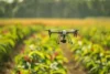
- Remote Sensing & GIS in agriculture refers to the use of satellite, drone, or aerial imagery (remote sensing) combined with Geographic Information Systems (GIS) to collect, analyze, and visualize geographic data about farmland. This technology helps monitor crops, assess soil, manage water resources, and support precision farming decisions.
Remote Sensing: Collecting information about the Earth’s surface from satellites, drones, or aircraft without direct contact.
GIS (Geographic Information System): A system for storing, analyzing, and mapping geographic data.
Combined Use: Integrates imagery and spatial data to support better farming and resource management.

3. How Remote Sensing & GIS Work Together in Agriculture
- Remote sensing gathers large-scale crop, soil, and environmental data.
- GIS organizes this data into easy-to-read maps and layers.
- Data integration allows detection of soil moisture, nutrient levels, and crop stress.
- Farmers get clear visual insights for targeted interventions.
- Historical trends can be compared for better planning.
- Results in reduced costs, higher yields, and sustainable farming.
- Precision Crop Management: Monitor plant health and apply inputs only where needed.
- Soil Mapping & Fertility Analysis: Identify nutrient levels and soil types for better crop planning.
- Irrigation Optimization: Design water systems based on actual field needs.
- Pest & Disease Tracking: Detect issues early before they spread.
- Climate & Weather Analysis: Prepare for upcoming risks.
- Yield Prediction: Estimate harvest size in advance.
- Land Suitability: Match crops with ideal land conditions.
5. Unique & Advanced Uses
- Detects weeds for targeted herbicide use.
- Spots early crop stress signs.
- Measures crop loss after disasters.
- Applies fertilizers at variable rates.
- Plans harvests for best market timing.
6. Real-Life Examples
- A farmer in India saved 40% water in drought conditions using GIS-based irrigation maps.
- In Africa, satellite data warned of a pest outbreak weeks before it was visible to the naked eye.
- A wheat farmer in Canada used remote sensing to detect nitrogen deficiencies and increased yield by 15%.
- Flood-prone villages in Bangladesh planned crop rotations to survive seasonal floods using climate-adaptive GIS planning.
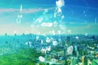
7. Future of Remote Sensing & GIS in Agriculture
- AI-powered image analysis for instant crop health detection.
- Real-time drone mapping for same-day farming decisions.
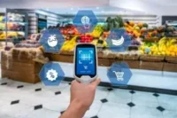
- Blockchain integration for fully traceable food supply chains.
- Climate change modeling for 50-year farming forecasts.
- Affordable satellite data for small-scale farmers.
- Autonomous farming equipment guided by GIS maps.
FAQs about Remote Sensing & GIS in Agriculture – Complete Guide
Here are some of the most frequently asked questions about the Remote Sensing & GIS in Agriculture – Complete Guide
Not exactly. While satellites do capture images, remote sensing also collects other data like temperature, moisture, and vegetation health using special sensors. It’s more than just photos—it’s about understanding the land from a distance.
No. GIS (Geographic Information System) is not just a mapping tool—it stores, analyzes, and compares all kinds of geographic data. The maps are only one way of showing the information.
Not with 100% accuracy, but it can give a strong estimate by tracking plant growth, health, and conditions over time. Farmers can then make better harvest plans.
It used to be, but now many affordable tools and mobile apps make it accessible even for small-scale farms. Some services even offer free basic satellite data.
Yes and no. You can store and view some GIS maps offline, but live updates or cloud-based analysis usually require an internet connection.
Conclusion
Remote Sensing & GIS in Agriculture work together to collect, analyze, and visualize data about crops, soil, and climate from a distance, helping farmers make smarter decisions. Remote sensing gathers information through satellites, drones, and sensors, while GIS organizes and maps this data for practical use. Understanding these technologies is important because they allow farmers to monitor crop health, optimize irrigation, predict yields, and prepare for climate challenges. By knowing these types and their uses, farmers can boost productivity, save resources, and protect their livelihoods in an increasingly unpredictable environment.


- Be Respectful
- Stay Relevant
- Stay Positive
- True Feedback
- Encourage Discussion
- Avoid Spamming
- No Fake News
- Don't Copy-Paste
- No Personal Attacks
- Be Respectful
- Stay Relevant
- Stay Positive
- True Feedback
- Encourage Discussion
- Avoid Spamming
- No Fake News
- Don't Copy-Paste
- No Personal Attacks
