Agribest Verifies Its Research with Remote Sensing in Agriculture
Published: 6 Apr 2025

Agribest is a leading agricultural technology company that specializes in using remote sensing and data analytics to improve farm productivity and sustainability. In recent years, the company has confirmed its research on how remote sensing technology can revolutionize crop monitoring, pest management, and precision agriculture.
So, guys, without wasting time, let’s jump into the article to learn Agribest Verifies Its Research with Remote Sensing in Agriculture
What is Remote Sensing in Agriculture?
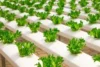
- Remote sensing involves the use of satellite or drone-based technology to gather data about crops, soil health, weather patterns, and other critical farming variables without physically being on-site.
- It provides farmers with real-time, precise data that can be used for crop health monitoring, irrigation management, and pest/disease detection.
Technologies Used by Agribest
- Satellite Imaging
- Technology: Agribest uses satellite-based remote sensing to monitor large-scale farming operations. These satellites capture high-resolution images of the fields, allowing for the detection of anomalies like drought stress, pest infestations, and nutrient deficiencies.
- Impact: Real-time data allows farmers to address problems before they become widespread, ensuring timely interventions that improve crop yield.
- Drone-based Monitoring
- Technology: Drones equipped with multispectral and thermal cameras are used for close-up field monitoring. These drones capture detailed images of the crops’ health by measuring variables such as temperature, moisture levels, and chlorophyll content.
- Impact: Drone data helps farmers make informed decisions on fertilization, irrigation, and pest control, optimizing resource use and reducing costs.
- Data Analytics and AI
- Technology: Agribest uses AI-powered analytics to process the data collected from satellites and drones. This allows for detailed analysis and actionable insights into soil health, crop growth stages, and environmental conditions.
- Impact: The AI systems help farmers optimize their practices by predicting potential issues and providing recommendations based on weather forecasts, soil analysis, and crop conditions.
- Precision Irrigation
- Technology: Remote sensing data is integrated with precision irrigation systems, ensuring that water is distributed only where and when it’s needed. By analyzing soil moisture levels, sensors activate irrigation systems to reduce water wastage.
- Impact: This technology leads to significant water conservation and cost savings, especially in regions facing water scarcity.
How Remote Sensing Enhances Farming
- Increased Crop Yields
- Through the use of remote sensing, Agribest confirmed that precision agriculture practices could increase crop yields by 15-25% by ensuring more accurate use of fertilizers, pesticides, and water.
- Example: A farm in Southern Africa, using remote sensing to monitor crops, experienced a 20% increase in yield after adjusting irrigation practices based on sensor data.
- Early Pest & Disease Detection
- Agribest’s research showed that remote sensing can detect pest and disease outbreaks before they become visible to the naked eye.
- Impact: By detecting early signs of disease or pest infestations, farmers can take preventive action, minimizing crop loss and reducing pesticide usage.
- Environmental Sustainability
- By optimizing the use of water, fertilizers, and pesticides based on precise data, Agribest’s remote sensing technology helps reduce environmental impact.
- Impact: It supports sustainable farming by reducing resource waste and minimizing chemical runoff, which can harm surrounding ecosystems.
- Cost Savings
- Remote sensing allows farmers to pinpoint areas in need of intervention, avoiding overuse of inputs like fertilizers, water, and pesticides.
- Impact: The savings on unnecessary resources can amount to thousands of dollars per season, significantly improving the farm’s financial health.
Challenges Faced in Implementing Remote Sensing
- Initial Investment Costs
- Remote sensing technology, especially drones and satellites, involves a high initial cost for equipment and software.
- Solution: Agribest has partnered with financing institutions to offer subsidized packages and support for small and medium-sized farmers to adopt these technologies.
- Data Interpretation
- While remote sensing provides large amounts of data, interpreting it correctly requires expertise. Many farmers struggle with how to act on the insights.
- Solution: Agribest provides farmers with user-friendly dashboards and dedicated support to help them understand and implement the recommendations.
- Connectivity in Remote Areas
- In some regions, reliable internet connectivity can be an issue, making it difficult for farmers to access remote sensing data in real-time.
- Solution: Agribest has developed offline capabilities, allowing data to be downloaded when connectivity is available and processed later.
Results and Impact of Agribest Remote Sensing Technology
- Improved Crop Management
- With precise data on weather patterns, soil moisture, and crop health, farmers are able to manage their crops more effectively, reducing wastage and maximizing output.
- Example: A farm in India using Agribest’s remote sensing saw a 30% reduction in water usage without affecting crop quality.
- Better Resource Allocation
- Remote sensing data helps farmers allocate resources (water, fertilizers, pesticides) more efficiently, improving both profitability and sustainability.
- Example: A wheat farmer in Australia reduced fertilizer costs by 40% after using remote sensing technology to adjust application rates.
- Access to Global Markets
- By increasing yields and ensuring consistent quality, farmers are able to meet international standards and gain access to global markets.
- Impact: Agribest technology has helped farmers improve their market competitiveness, opening up new opportunities for export.
Future Outlook
- Agribest plans to expand its research and roll out more localized solutions for farmers in developing regions.
- The company is also working on improving AI algorithms to offer even more precise recommendations and enhance the accuracy of predictions based on remote sensing data.
FAQs about Agribest Remote Sensing in Agriculture
Here are some of the most frequently asked questions about Agribest with Remote Sensing in Agriculture
Agribest is using remote sensing technology to verify and support its research in agriculture. This involves gathering data from satellites, drones, or other remote tools to monitor crop health, soil conditions, and other important factors.
Remote sensing helps in collecting precise and real-time data from large agricultural areas. It allows researchers to monitor crop growth, detect pests, diseases, and optimize irrigation, which helps improve farm productivity and sustainability.
Remote sensing provides Agribest with accurate and up-to-date information that is hard to gather through traditional methods. It helps in making better decisions based on data rather than assumptions, improving the overall effectiveness of their agricultural research.
The data collected includes images and measurements of crop health, soil moisture, temperature, plant growth, and areas with potential issues like pests or diseases. This information helps researchers and farmers make more informed decisions.
Agribest uses remote sensing technology to gather data from the field, which is then compared with traditional research methods to validate findings. This ensures that their research is accurate and based on reliable, real-time information.


- Be Respectful
- Stay Relevant
- Stay Positive
- True Feedback
- Encourage Discussion
- Avoid Spamming
- No Fake News
- Don't Copy-Paste
- No Personal Attacks
- Be Respectful
- Stay Relevant
- Stay Positive
- True Feedback
- Encourage Discussion
- Avoid Spamming
- No Fake News
- Don't Copy-Paste
- No Personal Attacks
