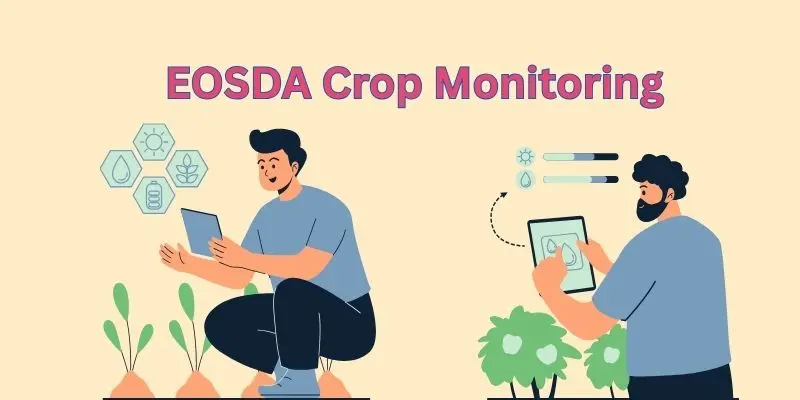
EOSDA Crop Monitoring: The Satellite Tool Helping Farmers Grow Smarter, Save More, and Stress Less
Published: 27 Jun 2025

Are you tired of walking through your fields, wondering if something’s wrong — but not seeing anything with the naked eye? Ever felt unsure about whether your crops are getting enough water, or if a pest problem is silently spreading? Maybe you’ve sprayed fertilizer across the entire field, only to find out later that some areas didn’t need it at all. If you’re relying on guesswork or outdated routines, you’re not alone — and that’s exactly where most losses begin. What if there was a way to actually see your crop health from above, get early warnings, and make data-backed decisions — all without stepping out of your house? That’s what EOSDA Crop Monitoring was built for.
So, guys, without wasting time, let’s jump into EOSDA Crop Monitoring: The Satellite Tool Helping Farmers Grow Smarter, Save More, and Stress Less
1. Why Farming Needs More Than Just Gut Feeling
- Modern farming is not just about hard work — it’s about smart decisions.
- Problems like pests, dry zones, or diseases often go unnoticed until it’s too late.
- Walking the field takes time, misses details, and isn’t scalable.
- EOSDA gives farmers a digital eye in the sky — seeing stress before it becomes visible.
2. What Is EOSDA Crop Monitoring?
- A powerful satellite-based digital farming platform
- Tracks crop health, soil condition, and weather — from anywhere
- Works via desktop or mobile, no special equipment needed
- Helps small, medium, and large farms optimize land and save inputs
3. Key Features That Transform Your Field Into a Smart Field
- NDVI & Other Vegetation Indexes
- Color-coded maps to show healthy vs. stressed areas in real-time
- Visual, easy-to-read, updated every few days from satellite images
- 14-Day Hyperlocal Weather Forecasting
- Plan irrigation, harvesting, and spraying with confidence
- Reduces unexpected losses from weather surprises
- Crop Stress Detection & Alerts
- Early warnings when crops show signs of disease, drought, or nutrient deficiency
- Act faster, save more
- Zoning for Variable Rate Applications (VRA)
- Customize where to apply fertilizer, water, or pesticides
- Reduce costs and increase efficiency
- Field Activity Logs
- Track what you did, when, and where — like a digital farm diary
- Helps during audits, certification, or planning next season
4. Why Farmers Love It (Emotional Benefits)
- Less Guesswork
“I no longer wonder what’s wrong — I can see it.” - Peace of Mind
“Even when I’m away, I know what’s happening in my fields.” - Savings That Matter
“I apply inputs only where needed — and my expenses have dropped.” - Time Back
“No need to walk every acre every day. I let the data guide me.”
5. Financial Benefits — It Pays for Itself
- Save up to 30% on fertilizer and chemicals with precise zoning
- Boost yields by spotting stress before it ruins crops
- Reduce unnecessary labor and fuel use
- Less time in the field = more time planning, selling, or resting
- It’s like investing in a helper who works 24/7 and never misses a thing
6. How Easy Is It to Use?
- Register and draw or upload your field
- Instantly start receiving satellite data and vegetation maps
- Set alerts for crop stress, low NDVI, or weather shifts
- Dashboard is visual, user-friendly, and made for farmers — not coders
- If you can use a smartphone, you can use EOSDA
7. Who Can Use EOSDA Crop Monitoring?
- Small Farmers — Reduce costs, improve awareness
- Agri Researchers — Analyze crop behavior over time
- Agribusinesses — Monitor multiple fields at once
- Students & AgTech Startups — For trials, research, or demos
- A global tool with local power — already trusted in 60+ countries
8. Future-Proof Your Farming — Why It Matters Now
- Climate change means unpredictable growing seasons
- Pest outbreaks are harder to control without early detection
- Water scarcity makes precision essential
- Market competition demands better data-based decisions
- Smart farming is no longer optional. It’s the edge every farmer needs
No, EOSDA is much more than a weather app. It uses satellite images to monitor crop health, track field activity, and detect issues like drought or disease before they become visible.
Yes, you don’t need any technical skills to use EOSDA. The platform is made for farmers and uses simple dashboards, color-coded maps, and alerts that are easy to understand.
No, EOSDA works completely online. You just need to register your fields using a phone or computer, and the satellite starts monitoring from above — no hardware needed.
EOSDA uses vegetation indexes like NDVI that read how much light plants reflect. If plants reflect less healthy light, it signals stress like drought, pests, or poor nutrients.
Not at all. EOSDA is helpful for small farms too — even a single field. It helps farmers of any size use resources wisely and spot problems early.
The satellite captures images every few days, which are quickly processed into maps. While not real-time like a camera, it’s updated frequently enough to detect issues early.
9. Final Thought
The article explains how EOSDA Crop Monitoring uses satellite technology to give farmers real-time insights into crop health, weather forecasts, field stress, and resource management. Key features include NDVI-based vegetation maps, zoning for precision input application, hyperlocal weather updates, and instant alerts for stress or disease. These tools help reduce costs, save time, and improve yields by replacing guesswork with smart, data-driven decisions. Understanding these tools is essential for farmers who want to stay competitive, sustainable, and prepared in an era of climate change and rising input costs.

- Be Respectful
- Stay Relevant
- Stay Positive
- True Feedback
- Encourage Discussion
- Avoid Spamming
- No Fake News
- Don't Copy-Paste
- No Personal Attacks

- Be Respectful
- Stay Relevant
- Stay Positive
- True Feedback
- Encourage Discussion
- Avoid Spamming
- No Fake News
- Don't Copy-Paste
- No Personal Attacks


