GIS in Agriculture: Best Practices for AgriTech Leaders
Published: 10 Aug 2025
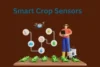
Did you know that farmers using GIS technology can increase crop yields by up to 25% while reducing input costs by nearly 30%? GIS in agriculture is more than just a mapping tool—it’s a revolutionary technology that collects, analyzes, and visualizes geographic data to make farming smarter, faster, and more sustainable. From soil analysis to precision irrigation, GIS empowers AgriTech leaders and farmers to make data-driven decisions that transform the way food is grown.
So, guys, without wasting time, let’s jump into the article to learn the GIS in Agriculture: Best Practices for AgriTech Leaders
What is GIS in Agriculture?

GIS in agriculture refers to the use of Geographic Information System technology to collect, analyze, and visualize spatial and geographic data for farming purposes. It helps farmers and agricultural professionals make informed decisions by mapping soil types, tracking crop health, planning irrigation, and managing resources efficiently.
- Full Form: Geographic Information System in agriculture.
- Purpose: Collect, analyze, and display geographic data for farming.
- Function: Maps soil, crops, and resources.
- Goal: Improve efficiency, productivity, and sustainability in agriculture.
How does GIS improve agriculture?
GIS in agriculture uses location-based data to help farmers work smarter, boost productivity, and make farming more sustainable.
- Improves resource efficiency.
- Increases crop yields.
- Reduces farming costs.
- Detects problems early.
- Supports sustainable farming
Agricultural GIS Data: ” Sources and Processing
Agricultural GIS data is the backbone of modern precision farming, providing the critical insights needed to make informed decisions in the field. This data is gathered from multiple sources such as satellite imagery, drone surveys, GPS devices, field sensors, and government agricultural databases. Once collected, it goes through a processing phase where advanced software cleans, organizes, and analyzes the information. The result is accurate, easy-to-read maps and reports that reveal soil conditions, crop health, and environmental factors—empowering farmers to plan, monitor, and manage their operations with precision and confidence.
Types of GIS in Agriculture
GIS in agriculture is transforming how farmers understand and manage their land. By using location-based data, it allows precise mapping, monitoring, and decision-making that improve crop yields, resource efficiency, and sustainability.
- Mapping and Visualization GIS
- Remote Sensing GIS
- Precision Agriculture GIS
- Soil Mapping GIS
- Crop Monitoring GIS
- Irrigation Management GIS
- Yield Mapping GIS
- Land Use Planning GIS
- Pest and Disease Mapping GIS
- Climate and Weather Analysis GIS
Applications of GIS in Agriculture
- Precision crop monitoring – Track crop health and apply inputs where they are most needed.
- Soil mapping – Identify soil types and fertility for better crop planning.
- Irrigation planning – Design and manage efficient water usage systems.
- Pest and disease control – Detect and respond to infestations early.
- Weather forecasting – Predict climate patterns to plan farming activities.
- Yield prediction – Estimate harvest output in advance.
- Land suitability analysis – Determine the best crops for specific land areas.
- Supply chain management – Optimize harvesting, storage, and transportation.
GIS gathers data from satellites, drones, and sensors, then turns it into maps and actionable insights. Farmers can see:
- Soil health zones — where land needs more nutrients or rest.
- Moisture levels — preventing water wastage.
- Crop health changes — spotting stress before it’s too late.
- Yield predictions — helping plan harvests better.
How GIS is Shaping the Future of Farming
- Transforms farming with data-driven decisions
- Improves crop yields and quality
- Reduces costs and resource waste
- Supports sustainable agriculture
- Helps farmers adapt to climate change
How GIS is Changing Farming
- Helps farmers make better decisions
- Grows more crops with better quality
- Saves money and reduces waste
- Protects the environment
- Helps deal with changing weather
- Gives instant updates from the fields
FAQs about GIS in Agriculture:
Here are some of the most frequently asked questions about the GIS in Agriculture: Best Practices for AgriTech Leaders
Not exactly. GIS is more than a map—it’s a system that collects, analyzes, and displays farming data like soil health, crop growth, and weather patterns. Different types of GIS offer different ways to access and use this data.
No, each type of GIS is designed for different purposes. For example, desktop GIS is for detailed analysis, while mobile GIS is for quick fieldwork.
It depends on your needs. Mobile GIS is great for on-the-go data collection, but desktop GIS is better for deep analysis and creating detailed maps.
Not really. Web-based GIS lets you access farming data, share it with others, and work from anywhere without needing special software.
No, you can choose the type that fits your work. Many farmers use just one or two types based on their budget and goals.
Conclusion
GIS for agriculture uses geographic data and mapping tools to help farmers monitor crops, analyze soil, plan irrigation, track pests, and predict yields. The main types—desktop, web-based, mobile, enterprise, 3D, and real-time GIS—offer different features for data collection, analysis, and sharing. Knowing these types is important because it helps farmers and AgriTech professionals choose the right tools for their needs, improving productivity, reducing costs, and promoting sustainable farming.


- Be Respectful
- Stay Relevant
- Stay Positive
- True Feedback
- Encourage Discussion
- Avoid Spamming
- No Fake News
- Don't Copy-Paste
- No Personal Attacks
- Be Respectful
- Stay Relevant
- Stay Positive
- True Feedback
- Encourage Discussion
- Avoid Spamming
- No Fake News
- Don't Copy-Paste
- No Personal Attacks
