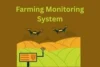
Satellite Crop Monitoring: The Smart Way to Farm from the Sky
Published: 29 Jun 2025
You’re walking through your fields, and everything looks fine — but something feels off. A few plants are yellowing, yields aren’t matching your effort, and you’re wondering: Is it a nutrient issue? Too much water? Not enough? You try to guess, hope for the best, and wait. But what if you didn’t have to guess anymore? What if you could see exactly what’s happening in your crops — from above, in real time? That’s where satellite crop monitoring steps in, turning uncertainty into insight.
So, guys, without wasting time, let’s jump into the article to learn the Satellite Crop Monitoring: The Smart Way to Farm from the Sky
What Is Satellite Crop Monitoring?
- It’s the use of satellite technology to observe, analyze, and manage crop health remotely.
- Satellites capture high-resolution images of farmland using tools like NDVI (Normalized Difference Vegetation Index).
- Farmers get real-time insights into crop growth, health, water stress, and nutrient deficiencies.
- This technology is part of precision agriculture, making farming smarter and more efficient.

Why Satellite Monitoring Matters
- “No more blind farming.” Know exactly what your field needs, and when it needs it.
- “Stop wasting time, water, and money.” Focus your efforts only where necessary.
- “Sleep peacefully, knowing your crops are being watched 24/7.”
- “Protect your harvest before it’s too late.” Catch diseases and stress early.
- “Use every drop of water wisely.” Support your crops while saving the environment.
Key Benefits of Satellite Crop Monitoring
Satellite crop monitoring offers powerful benefits that help farmers grow smarter, reduce waste, and protect their crops like never before.
1. Real-Time Field Monitoring from Anywhere
- Stay connected to your farm without being physically there.
- Get updates via your phone, tablet, or laptop.
- Useful for farmers with multiple fields or remote areas.
2. Early Detection of Crop Stress & Disease
- Spot problems like drought, pest attacks, or nutrient deficiencies early.
- Prevent crop loss before it becomes visible to the naked eye.
- “Don’t find out when it’s too late.”
3. Increase Crop Yield with Precision Insights
- Identify underperforming zones and take action.
- Apply fertilizers or irrigation only where needed.
- Better planning = better harvests.
4. Reduce Farming Costs
- Stop wasting inputs (water, pesticides, fertilizers).
- Save fuel, labor, and time.
- “Cut costs without cutting corners.”
5. Make Smarter, Faster Farming Decisions
- Use data to decide what your crops need — no more guessing.
- See growth stages, chlorophyll levels, and soil moisture with accuracy.
- Optimize every farming operation.
6. Achieve Sustainable Farming Goals
- Protect soil health and reduce environmental harm.
- Use resources efficiently, reducing runoff and pollution.
- “Farm today without compromising tomorrow.”
7. Visual Maps to Understand Your Fields Better
- NDVI and crop health maps help you ‘see’ your farm from the sky.
- Track seasonal changes, field differences, and crop vigor.
- Intuitive visuals = better decision-making.
Who Should Use Satellite Monitoring?
- Large-scale farmers managing 50+ acres
- Remote farm managers who can’t visit fields daily
- Sustainable and organic growers aiming for precision
- Agri-tech advisors and consultants helping others optimize
- Any farmer who wants to farm smarter, not harder
How to Start Using Satellite Monitoring
- Choose a trusted platform (e.g., EOSDA Crop Monitoring, Climate FieldView, etc.)
- Sign up and map your fields digitally
- Start receiving updates, alerts, and insights in minutes
- Use the data to adjust irrigation, spraying, and harvesting
- Track crop health across weeks and seasons
FAQs about Satellite Crop Monitoring
Here are some of the most frequently asked questions about Satellite Crop Monitoring: The Smart Way to Farm from the Sky
No, it’s different. While drones cover small areas at low altitude, satellites give you a full view of your fields from space — no flying required.
Yes! Satellites use special sensors to detect plant stress, even before you can see it with your eyes. They show crop health through color maps and indexes like NDVI.
Nope. The satellites collect data from space, and you access it later through an app or website when you’re online.
They show which areas are dry and stressed. This helps you water only where it’s needed, saving both time and water.
Not at all. Even small farmers can use it to check crop health, spot problems early, and improve harvests. Many services are affordable and easy to use.
No equipment needed! Just sign up with a satellite crop monitoring service online. All the data comes from space — no installation required.
Emotional Closing:
Satellite Crop Monitoring: The Smart Way to Farm from the Sky highlights how modern farmers can use satellite technology to remotely track crop health, soil conditions, and field performance in real-time. It emphasizes the ability to detect issues like drought, disease, or nutrient deficiency early—before visible damage occurs. With tools like NDVI and precision maps, farmers can make informed decisions, optimize resource use, reduce input costs, and boost yields. Understanding these monitoring methods is crucial for adopting smarter, more sustainable, and profitable farming practices in today’s climate-sensitive world.


- Be Respectful
- Stay Relevant
- Stay Positive
- True Feedback
- Encourage Discussion
- Avoid Spamming
- No Fake News
- Don't Copy-Paste
- No Personal Attacks
- Be Respectful
- Stay Relevant
- Stay Positive
- True Feedback
- Encourage Discussion
- Avoid Spamming
- No Fake News
- Don't Copy-Paste
- No Personal Attacks
